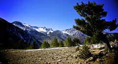
The AGT is a 114 km trail that takes 8 days to hike…it is certainly no joke and gives you an appreciation for enormity and harshness of the wilderness here in Patagonia. I took the following two sections from the itinerary created by Patagonia Adventure Expeditions because it provides some nice history and information about this trip.
Aysén, Chilean Patagonia
There are several theories as to the origins of the name Aysén. The most popular is that early explorers and cartographers working from ships, often commanded by British naval officers, would refer to the many tidewater glaciers or “Ice Ends” in a mix of English and Spanish, which eventually became Aysén.
The Aysén region is the most recently developed and least populated area of Patagonia. Surface area is 42.519 square miles with a population density of approximately 1.2 people per square mile. 48% of the land is protected with (un-protected) lakes, glaciers, native forests and uninhabited islands that account for a further 20%. Aysén is still a frontier, bounded to the west by the Pacific Ocean where a multitude of uninhabited islands in the Chonos and Katalalixar archipelagos can be found. Argentina lies to the east where the Andes transition from verdant forest to mountains and on to the grassy plains of the pampas, creating a rich biodiversity. The two continental ice fields are the world’s 3rd largest reserves of water.
Remarkably, you can drink directly from rivers, streams and lakes with no water treatment being necessary. Clean, free flowing rivers and intact hydrologic basins from the ice to the ocean are the region’s most valuable asset and least known environment.
Aysén Glacier Trail
The Aysén Glacier Trail is a trekking route bordering the Northern Patagonian Ice Field
between Lago Bertrand and the confluence of the Baker and Colonia Rivers in Aysén,
Chilean Patagonia. The trail consists of six permanent campsites that contain six 3-person tents at each site, cooking facilities, stocked dry goods, dining shelter and bathrooms.
There are also full sized air/foam mattresses at each site for all guests. The trail is protected on both ends by lakes. This means that on Day 2 of the itinerary, we cross Lago Bertrand and Lago Plomo in a motor boat to reach the trailhead, and on Day 8 Lago Colonia is similarly crossed. These natural boundaries and the exclusive rights that Patagonia Adventure Expeditions has to the commercial operation of the route through both private land and the Laguna San Rafael National Park guarantee your complete wilderness experience. The Laguna San Rafael National Park is on its way to becoming an UNESCO World Biosphere Reserve.
Our group consisted of eight people. Two clients, Greame, a travel writer, journalist, and photographer from England, (for some interesting articles, issues, and photos check out his website at www.graemegreen.org) and John, from the US who works for Exxon/Mobil as a geophysicist. Traveling with us was a new employee, Carina, who has a degree in ecotourism and was on the trip to learn about the trail in order to make improvements and promote the trip. The three guides were Soto (Chile), Gringo (Chile), and Zac (USA). Oh yeah…and me.
On the first day, we took a boat ride across Lago Bertrand and Lago Plomo. When we exited the boat, Gringo realized he forgot a sleeping bag. Needless to say, it would be a chilly first couple nights for him, even though he slept with half of his body in a dry bag and and used whatever extra clothes we had to cover the rest of his body. We hiked up a monster of a mountain and had a beautiful overlook of the Valle Soler. Later that night, we would find out that for whatever reason, not only did Gringo forget his sleeping bag but he was also starting to get a cold and had a horrendous cough…that only started when we laid down to sleep. It definitely made sleeping a fun challenge and became a group joke after eight nights of listening to his symphonic cough.
The next day we were met with beautiful weather. We hiked towards Palomar Ranch at the back of the Valle Soler. We had to scramble up some sketchy paths clinging to roots and small rock holds, walk along the edges of fairly good sized cliffs, and use ropes to help us downclimb in a couple places. After hiking through an old growth forest we reached the ranch and later had a delicious chicken dinner and bathed (separately) in the river to a beautiful backdrop of mountains.
This next day was HUGE. An eleven hour trek while carrying packs weighing somewhere around 80 lbs. As we started out through the old growth forest, every joint in my body started to scream. I thought, “WOW! Today is gonna suck!” Every step had to be calculated and secure because being nimble is not really an option with this much weight on your back. We came out of the forest into a beautiful open field only to be followed by a 600 ft ascent, and for whatever reason, the elevator was out of service. Muscles burned, joints ached, and lungs needed more oxygen, but the view and clean air made it easy to keep going. At the top, we approached the Nef Glacier. I couldn’t believe that I was actually here. Never in my life had I ever expected to see a glacier in person, let alone walk across one.
Videos:
Group walking down talus slopes and onto glacier
Carina and Jeff walking onto glacier
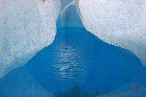
We slowly made our way across the talus slops and then onto the glacier. We strapped on our crampons (and of course, I got yelled at by the guides because I started to run around with crampons, in other words…knives willingly strapped to your own feet). They proceeded to explain crampon safety to everyone and my childish behavior was used as a great example of what not to do…I did it on purpose…yeah, we’ll go with that. As the crow flies, we needed to go about 3.5 miles, but in reality we must of walked 5-6 miles because we had to zig and zag around crevasses and cliffs in the ice. It was absolutely amazing. There were rivers of the purest water in the world, bright blue ice patches, and sometimes holes in the ice that seemed to lead to the center of the Earth. We stopped to have lunch on the glacier and to indulge in the bottle of triple distilled, single malt scotch that John brought along accompanied by four rocks of glacial ice to give it a nice chill. I have never had anything like it.
Quick water facts.
- 2.5% of all Earth’s water is fresh and 2/3s of that water is locked up in glaciers (now a little less since we drank a bunch of the runoff used some ice for our whiskey. Sorry to drain the world’s water reserves for our selfish purposes).
- Less than 3/10 of 1% of total freshwater is available in liquid form at the surface of the planet. Remainder is in permafrost, soil moisture, plants and animals, water vapor.
- Most accessed source of water for humans is rivers and streams – these hold about 6/1000s of 1% of total
- A healthy human needs to consume 2-3 quarts of freshwater/day
Based on 2-3 quarts/day the following deficiencies can occur:
- 1% deficiency = thirst
- 5% deficiency = fever
- 10% deficiency = immobility
- 12-15% deficiency = death after about a week
After our little break, we made our way to the glacial terminus where we took off our crampons because there was a lot of rocky material making it difficult to walk. However, hidden beneath the sand, gravel, and rocks was all ice. Basically, no step could be trusted at this point (I’m actually being really serious here) not to mention the 80 lbs attached to our backs and the approaching rainstorm and wind gusts which made things a bit more tricky, especially when walking on the edge of a slippery, icy cliff. After we passed the glacial terminus, we had to ascend another few hundred feet of slippery, chossy morraine, where we reached our final camp in the Laguna San Rafael National Park.
The next day was a rest day and boy did I rest. I slept in until 12:30 and when I got up, I almost fell over because so many parts of my body had fused together overnight. Eventually they loosened up but I had giant blisters on my heels which actually hurt the most. Luckily the weather was beautiful again but rather than being trapped by rain at camp we were trapped by the flies. We had to stay in tents, around the fire, or in a small supply shed to hide from them, and for whatever reason, the Tabanos (horse flies) seemed to have experienced exponential growth overnight. They had always been bad but now it was terrible that we had to cover up. Imagine going to the bathroom…doesn’t sound charming? It wasn’t.
Tabanos terrorize Graeme and add to the atmosphere of fine dining in the woods
We left the next morning and walked through Valle Buena Cueva with old growth beech but when the sun came over the rim, we were mauled by flies. It actually became pretty funny how bad they were and we started catching flies and throwing them into rocks. I know you are thinking this is probably not very humane, but I am pretty sure karma will not be after us for getting our paybacks from fly killing.
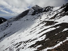
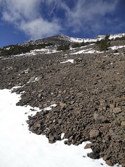
We made our way along the talus slopes of Lago Cachet Dos with amazing views of the Colonia Glacier. We had to walk on very unstable rock slopes while getting attacked by flies, it was like being on an adventure game show; doing something extremely dangerous while being distracted by something stupid.
Lago Cachet Dos is famous for its Glacial Lake Outburst Floods (GLOFs). Ice dams will break and the entire lake will drain below the glacier in about 10 hours causing a massive amount of water to flow down the Rio Colonia. This is one of the arguments against the dams because there is some uncertainty if the dams are built that they might not be able to withstand a very large GLOF. The locals living along the banks have a radio system to communicate in case a GLOF occurs which gives them time to retrieve cattle, sheep, and horses. There are also cameras and gauges that are always monitoring the lake levels and when it drops below a certain height, it sends out a warning signal.
 This ice is around 200 ft tall…just from the water line!!!
That night it started raining and held on for the remainder of the morning. We walked from camp, down the mossy mountain side, along the beach from the Colonia Glacier to Lago Colonia. Here we were to be picked up by a boat, but no one was there. It was freezing and the rain and winds did not help. We waited for about an hour and then made a fire and I started to run around on a part of the beach and liquified the sand. Liquefaction at its best, but this is basically what happens to the Earth during a serious earthquake. The waves cause saturated, unconsolidated sediments to rearrange and act as a liquid.
My liquefaction demonstration video
As I played, and people warmed themselves by the fire, Soto was talking on the Satellite phone trying to figure out what happened with the boat, if we needed to take a helicopter to fly us across the lake, or if we needed to head back to camp. It ended up that no helicopters would come out because it was not an emergency and we did not know what happened to the boat so we headed back to camp. It was a nice day to read, relax, and enjoy the scenery.
We left again the next morning and when we arrived on the banks of the lake, there was Lucho (a gaucho working at Sol de Mayo ranch) and the boat. Apparently, there were problems the previous day so we took the boat apart, reassembled it and crossed the lake. This beach was the end of the trip for the NIDO students and I. We made our way back to the ranch where we decided rather than hike out the remaining 28 km, we would relax for one more night.
Our final day ended with a fast paced hike out of Valle Colonia. We hiked the 28 km (17 miles) in about five hours and passed though the ranches of Don Julio, Don Domingo, and Don Umberto and Señora Isabelle. We crossed Rio Baker on the ferry, off-roaded for two hours, and cruised the dirt road back to Puerto Bertrand. Surprisingly, I couldn’t fall asleep until 12:30 am, but there was no doubt in my mind I would sleeping well.


